Day trips
Lake Bosomtwe Day Trip from Kumasi by Car: Route, Timings and Car Rental & Hire
Quick answer: For a Lake Bosomtwe day trip from Kumasi, you drive south-east to Kuntanase, the district capital, then down over the crater rim to Abono, the main lakeside village for visitors. There are two ways out of Kumasi: south through Atonsu, Aputuogya and Jachie, or east on the Accra road to Ejisu and then south. The district says Kuntanase is "about 30km" from Kumasi. No official road distance or drive time to Abono, and no official entry fee, is published, so we don't quote any. Parts of the road are being rebuilt in 2026, so expect dust or mud. Leave in the morning and be back in Kumasi before dark.
This guide covers a day trip by car from Kumasi to Lake Bosomtwe (also spelt Bosumtwi): the two routes, what official sources say about distance and time, the road works in 2026, what to do at the lake, safety on the water, and how to book car hire & rental with a driver. If you only need a driver for the day around Kumasi, our Kumasi car hire with a driver guide covers day rates and other trips such as Bonwire.
Lake Bosomtwe at a glance
| Question | What we found (checked 5 November 2026) |
|---|---|
| Where | Bosomtwe District, Ashanti Region |
| Main visitor village | Abono |
| District capital | Kuntanase, "about 30km" from Kumasi (district budget) |
| Kumasi–Abono road distance | No official figure |
| Drive time | No official figure |
| Size | 49 km², 70–73 m deep (GTA) |
| UNESCO status | Biosphere reserve, nominated 2016 |
| Entry fee | "Small fee" at a community entry point (GTA); no amount published |
| Road works | Abidjan Nkwanta–Kuntanase section under construction (2026) |
What makes the lake special
The Ghana Tourism Authority calls Lake Bosomtwe "the only true inland lake in the country". It says the lake has no surface outlet, sits in a meteorite impact crater, covers 49 km² and is 70–73 metres deep, with steep crater sides rising 150–425 metres above the water.
UNESCO lists the area as a biosphere reserve (nominated in 2016, 28,698 ha). It says the lake is believed to have formed about 1 million years ago, when an asteroid impact crater gradually filled with rainwater, and that it is one of six meteoritic lakes in the world. Its catchment spans two districts, Bosomtwe and Bosome-Freho.
The lake is sacred to many Ashanti people. The GTA explains that touching the water with iron was traditionally taboo, so fishermen still use the padua, a wooden plank they sit on and paddle by hand.
Where Abono is
The Ministry of Finance's 2026 budget for the Bosomtwe District says the Assembly was established on 1 November 2007 by LI 1922, and that its capital, Kuntanase, is "about 30km from Kumasi". It doesn't say whether that's a road distance.
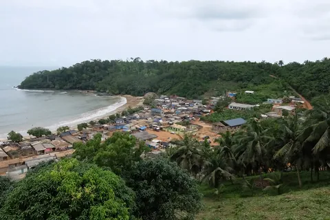
The same budget says only one settlement, Abono, a fishing community, has its tourism potential "relatively developed", with 24-hour electricity, lake transport and toilet facilities. Hotels, restaurants and open terraces are "springing up" around the lake. The GTA says the tarred road from Kumasi climbs over the crater rim and down to the lake, ending at Abono, the first village.
The two routes from Kumasi
The Ghana Highway Authority's 2020 Ashanti trunk road map shows two regional roads that meet at Petransa, just west of Kuntanase:
Route 1: south via Atonsu and Jachie (R-106)
- Leave central Kumasi heading south-east through Atonsu.
- Follow the R-106 south through Prapong, Esereso, Feyiase and Aputuogya.
- Carry on through Abidjan Nkwanta, Jachie, Swedru and Deduako No. 2 to Petransa.
- Turn east to Kuntanase, then down to Abono on the lake shore.
Route 2: east to Ejisu, then south (R104)
- Leave Kumasi east on the N6, the Accra road, to Ejisu.
- Turn south on the R104 through Onwe, Asienimpong, Kwaso, Piase and Edwinase to Petransa.
- Turn east to Kuntanase and Abono.
This is the route Graphic Online described in 2014: Abono is "the first community when approaching from Kuntenase, off the Accra-Kumasi road at Ejisu". It suits visitors coming from Accra, and those combining the lake with Ejisu or Bonwire.
The GHA map doesn't say which route is quicker, and we found no official guidance on that. Ask your driver which is in better shape on the day.
Road works on the Lake Road in 2026
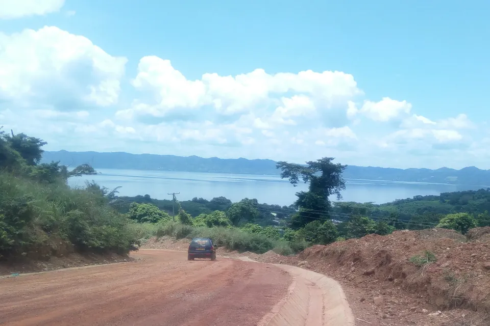
The southern route is known locally as the Lake Road. In August 2026, Citi Newsroom reported that contractors had returned to the stalled project. Work had stopped at Abidjan Nkwanta after the Ahinsan–Aputuogya stretch was finished, leaving motorists with heavy dust in the dry season and mud when it rains.
On 1 September 2026, the District Chief Executive told Adom News that the Abidjan Nkwanta–Kuntanase road would get its first coat of asphalt within two months. Motorists said they had not seen the contractor on site regularly. We found no report confirming that the asphalt had been laid, and no official completion date, as of 5 November 2026.
On the dual-carriageway section nearer the city, MyJoyOnline reported on 13 October 2026 that only 14 of the 95 traffic lights at eight intersections along the Asokwa–Aputuogya road were working. Take extra care at junctions.
We found no 2026 official report on the condition of the Ejisu–Kuntanase road (R104). The district budget lists the "poor conditions of road network" as one of its key challenges.
How far is Lake Bosomtwe from Kumasi, and how long does it take?
There's no official Kumasi–Abono road distance. The district budget says Kuntanase is "about 30km" from Kumasi, and Graphic Online described the lake in 2014 as "some 30km southeast of Kumasi". Neither is stated as a road distance or says where in Kumasi it's measured from. The GHA's road table lists only whole national roads, such as the N6 Accra–Kumasi at 250 km, not this trip.
There's no official drive time either. Traffic leaving Kumasi and the unfinished sections near Jachie decide how long it takes, so leave early and build in time.
If you're coming from Accra, see our Accra to Kumasi road trip guide for the N6. Doing Accra to the lake and back in one day isn't realistic, so stay in Kumasi or at the lake.
What to do at the lake
The GTA lists:
- The information centre, where you can learn about the lake and its conservation and arrange a boat trip
- Boat rides on the lake
- Swimming (see the safety section below)
- Hiking into the hills around the crater and the sacred areas near the villages
- Birdwatching, fishing and canoeing
UNESCO says visitors usually go hiking and recreational fishing. The GTA also notes the dead tree trunks standing in the water and the village names with numbers after them, because the lake has risen over time and villages have moved up the hillside.
Entry fees and opening hours
The GTA says there is "a small fee to be paid at a community-mounted entry point", but gives no amount. We found no official fee or opening hours from the GTA, the District Assembly or UNESCO as of 5 November 2026, so we don't quote any. Ask for a receipt. The UK FCDO warns visitors to beware of self-appointed officials trying to charge fees to take pictures at well-known sites.
Visitor numbers
The district budget records 17,546 tourist visits to Lake Bosomtwe in 2024 and 23,223 in 2025 up to September, with a target of 45,000 a year from 2026.
Safety on the water
The GTA warns that the padua plank boats "could easily capsize". We found no official lifeguard service, swimming rules or life-jacket requirement for Lake Bosomtwe from the District Assembly, the GTA or the Ghana Maritime Authority. The UK FCDO's swimming warning covers the beaches on the southern coast, not the lake.
Drownings do happen at Abono. In March 2014, for example, MyJoyOnline reported that a man drowned while swimming at a funeral gathering there, and local divers pulled him out before disaster officials arrived. So:
- Only swim where locals say it's safe, and never after drinking alcohol
- Don't swim alone, and keep children within arm's reach
- Ask for a life jacket before any boat ride, and don't go out if one isn't offered
The lake in 2026: environmental pressure
In April 2026, GNA reported that the Ashanti Regional Minister ordered an immediate halt to unauthorised land clearing around the lake, and asked the Environmental Protection Authority to investigate. MyJoyOnline reported that protected tree belts along the shore had been cleared by an unidentified developer. A Water Resources Commission official said the biosphere reserve was in its tenth-year review and could lose its UNESCO status if the core and buffer zones shrink.
None of this closes the lake to visitors, as far as we found. But please stick to paths, don't leave litter, and respect the shrines and sacred groves around the villages.
Daylight driving
For longer trips outside major cities, the UK FCDO's Ghana safety advice says to travel during daylight hours. It warns that roads can be poor, especially in rural areas, and advises avoiding road travel outside the main towns after dark, when street lighting is poor or non-existent and serious accidents are more likely.
The GTA describes the road climbing over the crater rim and down to the lake, and the unfinished sections are dusty or muddy. Plan to leave the lake by mid-afternoon.
Car rental & hire for a Lake Bosomtwe day trip
Most visitors book in Kumasi. Compare car hire & rental with a driver in Kumasi, or browse all car hire & rental firms in Kumasi. A local driver will know which route is in better shape and can wait while you walk or take a boat.
If you're flying in, our Kumasi airport arrivals guide explains pickups at Prempeh I International Airport. If you're carrying on to the coast afterwards, see our Kumasi and Takoradi car hire guide.
Agree the terms in writing
Before you go, agree these in writing (a WhatsApp message or email from the firm is fine):
| Agree in writing | Why it matters |
|---|---|
| Pickup time and address | So you leave Kumasi before the traffic builds |
| Route | Via Jachie or via Ejisu, depending on the road works |
| Hours included | Boat rides and hikes take time |
| Waiting time and overtime | So a long lunch doesn't become a dispute |
| Unpaved sections | Whether the firm is happy with dust or mud |
| Fuel and latest return time | So you know the price and are back before dark |
We don't publish prices, because they change often in Ghana. Ask each firm for a dated written quote, and never pay a deposit into a personal account that doesn't match the firm's name.
Frequently asked questions
How far is Lake Bosomtwe from Kumasi?
There's no official road distance to Abono. The Bosomtwe District budget says Kuntanase, the district capital, is about 30 km from Kumasi, and Graphic Online put the lake about 30 km south-east of the city. Neither is stated as a road distance.
How long does it take to drive from Kumasi to Lake Bosomtwe?
No official drive time is published. Traffic in Kumasi and unfinished road sections near Jachie and Kuntanase can add time, so leave in the morning.
Which road goes from Kumasi to Lake Bosomtwe?
There are two. The R-106 runs south from Kumasi through Atonsu, Aputuogya and Jachie to Kuntanase. The other option is the N6 east to Ejisu, then the R104 south to Kuntanase. Both continue down to Abono on the lake shore.
Is there an entry fee at Lake Bosomtwe?
The Ghana Tourism Authority says there is a small fee at a community entry point, but it publishes no amount. We found no official fee as of 5 November 2026, so ask locally and get a receipt.
Is it safe to swim in Lake Bosomtwe?
We found no official lifeguard service or swimming rules for the lake, and drownings have been reported at Abono. Only swim where locals say it's safe, never after drinking, and ask for a life jacket on any boat.
Can I visit Lake Bosomtwe from Accra in one day?
It isn't realistic. The N6 alone is 250 km from Accra to Kumasi, according to the Ghana Highway Authority. Stay a night in Kumasi or at the lake, and do the lake as a day trip from there.
Plan your trip
Compare car hire & rental with a driver in Kumasi. Send each firm your date, pickup address, number of passengers and the route you'd like, and ask for the price, hours and waiting terms in writing.
Sources
- Lake Bosomtwe: only true inland lake in Ghana, meteorite impact crater, 49 km², 70–73 m deep, crater sides 150–425 m above the water; information centre, boat rides, swimming, hikes; padua planks 'could easily capsize'; tarred road from the direction of Kumasi ending at Abono; small fee at a community entry point (no amount given; page dated 18 April 2025, checked 5 November 2026) (Visit Ghana, Ghana Tourism Authority)
- Ashanti Region: Lake Bosomtwi listed among points of interest for nature lovers (checked 5 November 2026) (Visit Ghana, Ghana Tourism Authority)
- Lake Bosomtwe Biosphere Reserve: nominated 2016, 28,698 ha, one of six meteoritic lakes in the world, formed about 1 million years ago, catchment spans Bosomtwe and Bosome-Freho districts, hiking and recreational fishing (checked 5 November 2026) (UNESCO Man and the Biosphere Programme)
- Bosomtwe District Assembly composite budget 2026–2029 (established 1 November 2007 by LI 1922; capital Kuntanase 'about 30km from Kumasi'; Abono the only settlement with relatively developed tourism; tourist visits to Lake Bosomtwe 17,546 in 2024 and 23,223 in 2025 to September; poor road network a key challenge) (Ministry of Finance)
- Road Network: N6 Accra–Kumasi 250 km; no Kumasi–Lake Bosomtwe figure (checked 5 November 2026) (Ghana Highway Authority)
- Ashanti Regional Trunk Road Map, 2020 (R-106 Kumasi–Atonsu–Esereso–Aputuogya–Jachie–Petransa–Kuntanase–Abono; R104 Ejisu–Onwe–Kwaso–Piase–Edwinase–Petransa) (Ghana Highway Authority)
- Pilgrimage to Lake Bosomtwe (about 30 km south-east of Kumasi, about 8 km wide, Abono reached via Kuntenase off the Accra–Kumasi road at Ejisu; 5 December 2014) (Graphic Online)
- Bosomtwe District: Stalled Lake road project resumes (work had stopped at Abidjan Nkwanta after the Ahinsan–Aputuogya stretch; dust in the dry season, mud in the rain; 19 August 2026) (Citi Newsroom)
- Abidjan Nkwanta to Kuntenase road to receive first coat of asphalt within two months – Bosomtwe DCE (1 September 2026) (Adom News (Multimedia Group, sister outlet of MyJoyOnline))
- Dark Signals: non-functioning traffic lights along the Asokwa–Aputuogya Road (14 of 95 lights working at eight intersections; 13 October 2026) (MyJoyOnline)
- Minister halts illegal land clearing around Lake Bosomtwe (EPA investigation ordered; 17 April 2026) (Ghana News Agency)
- Lake Bosomtwe faces loss of UNESCO status as developers destroy protected zones (ten-year biosphere review under way; 16 April 2026) (MyJoyOnline)
- Driver, 39, drowns in Lake Bosumtwe (Abono; rescued by local divers before NADMO arrived; 21 March 2014) (MyJoyOnline)
- Ghana travel advice: safety and security (daylight on longer trips; poor rural roads; roads outside main towns after dark; self-appointed officials charging photo fees; checked 5 November 2026) (UK FCDO)
Last checked: 5 November 2026. Rules, prices and advice change, so recheck official sources before you travel.
Related guides
Shai Hills Resource Reserve Day Trip from Accra by Car: Route and Car Rental & Hire
Shai Hills Resource Reserve day trip from Accra by car: the N2 route, official distance facts, baboon safety, the reserve in 2026 and car rental & hire.
Photo: Matti Blume, CC BY-SA 4.0