Road trips
Accra to Keta by Car: Distance, Hours, Route and Car Rental & Hire
Quick answer: Driving from Accra to Keta, you take the N1 east through Tema and over the Volta at Sogakope. Then you either turn south at Dablamornu towards Dabala, and follow the coast road through Anloga to Keta, or stay on the N1 to Denu and come back west along the coast. Keta Municipal Assembly's 2026 budget says Keta is about 3–4 hours by road from Accra. No official Accra–Keta road distance is published. The Assembly describes Keta as about 160 km east of Accra, but doesn't say that's by road. Plan to arrive in daylight.
Keta is the capital of Keta Municipal in the Volta Region. It sits on the strip of land between the sea and Keta Lagoon. This guide covers the drive from Accra: the route, what official sources say about distance and hours, the coastal erosion and sea defence works along this shore, and how to book car hire & rental with or without a driver.
How far is Keta from Accra?
| Question | What official sources say |
|---|---|
| Accra to Keta by road | No official road distance published |
| Keta's position | "About 160 km to the east of Accra, off the Accra–Aflao main road" (Keta Municipal Assembly) |
| Coast road from Havedzi through Keta, Anloga and Dabala to the Accra–Aflao road | 74.8 km (Keta Municipal Assembly budget) |
| N1 Elubo–Tema (whole road) | 540 km (GHA) |
| Journey time by road from Accra | Approx. 3–4 hours (Keta Municipal Assembly, 2026 budget) |
The Keta Municipal Assembly says the municipality is "located east of the Volta estuary, about 160km to the east of Accra, off the Accra-Aflao main road". That describes where Keta is. It isn't presented as a measured road distance, so treat it as a rough guide only.
The Ghana Highway Authority's road network table doesn't list an Accra–Keta figure. Route planners and travel blogs quote their own distances, but they aren't official sources, so we don't repeat them.
How many hours from Accra to Keta?
The Keta Municipal Assembly's 2026–2029 composite budget, published by the Ministry of Finance, says: "Keta is accessible by road from Accra (approx. 3-4 hours)". It gives Ho, the regional capital, as approx. 2–3 hours.
That's the only official journey time we found as of 27 October 2026. Your time will depend on traffic leaving Accra and Tema, roadworks and stops. Leave early enough to arrive before dark.
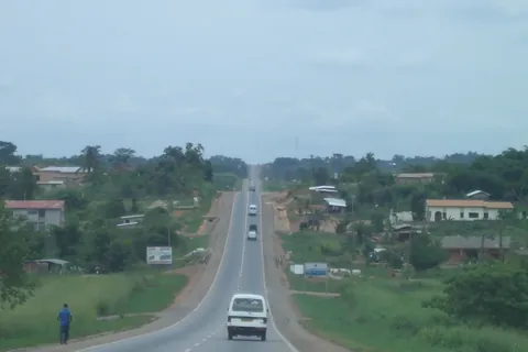
The route: N1 to Sogakope, then the Dabala or Denu side
The GHA's Volta Region trunk road map (2020) shows the roads.
1. Via Dabala and Anloga (the western approach)
- Leave Accra on the N1 (the Accra–Aflao road) through Tema.
- Cross the Volta at Tefle and Sogakope.
- Turn south at Dablamornu onto the R016 through Dabala, Lolito, Agortoe and Salo to Srogboe.
- Turn east onto the R011 through Anloga, Woe, Tegbi and Dzelukope into Keta.
Keta Municipal Assembly's 2026 budget describes this as the first-class road (74.8 km) that "traverses the coast from Havedzi through Keta-Anloga-Dabala to join the main Accra-Aflao Road". It's the same road you use for Anloga and the Hogbetsotso festival. Our Hogbetsotso festival guide covers the festival dates and getting around on the day.
2. Via Denu (the eastern approach)
- Stay on the N1 past Sogakope through Akatsi and Agbozume towards Aflao.
- Near Denu, turn south-west onto the R011 through Agavedzi, Kpedzi and Vodza to Keta.
The Assembly's budget says the Keta–Aflao stretch, which sea erosion had destroyed between Keta and Horvi, "has now been constructed under the Keta Sea Defense Project". It adds that town access roads into Keta from Denu and Anloga are "paved but often in moderate condition". For the N1 as far as the border, read our Accra to Aflao by car guide.
Roadworks and road condition (checked 27 October 2026)
Tema Roundabout–Dawhenya (N1). Graphic Online reported on 27 August 2026 that rehabilitation of the 17 km stretch from Tema Roundabout to Dawhenya was 23.11% complete, and the Minister of Roads and Highways told the contractors to speed up. Expect works and diversions on the way out of Tema.
Keta–Anloga road. GNA reported in April 2026 that the Anloga District had patched potholes on the main Keta–Anloga highway from Tegbi to Galo-Sota Junction. We found no 2026 GHA report on the condition of the Dabala road. Ask your driver about it before you set off.
Coastal erosion and the sea defences
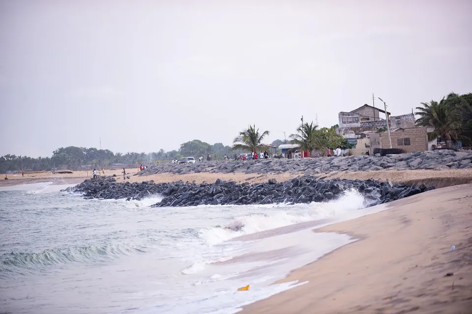
The coast road runs close to the sea, and erosion is a live issue here.
- Erosion rates. In October 2026, the Volta Regional Director of the EPA told a climate forum at Tegbi, reported by Graphic Online, that the sea claims "seven to eight metres of land every year" in Keta, Anloga, Fuveme and Agavedzi. He called for completion of the sea defence from Anloga to Blekusu.
- Blekusu project. GNA reported in January 2026 that Phase II of the Blekusu Sea Defence Project, protecting communities including Salakope, Amutsinu and Agavedzi, started in 2025, runs for four years and is due for completion in 2029.
- Knock-on effects. MyJoyOnline reported in September 2026 on a KNUST study that found the existing sea defence is redirecting some high-tide impacts towards communities without protection.
None of these reports says the coast road is closed. But high tides and tidal flooding are reported along this shore, so ask your driver or hotel about conditions before you travel.
Daylight driving and beach safety
For longer trips outside major cities, the UK FCDO's Ghana safety advice says to travel during daylight hours. It also advises avoiding road travel outside the main towns after dark, when street lighting is poor or non-existent.
The FCDO also warns that swimming is dangerous on beaches along Ghana's southern coast because of rip tides and undertows, with occasional deaths. It advises not visiting beaches alone. Keta's own budget says swimming at its beaches should be done "with caution due to strong currents".
What to see in Keta
- Fort Prinzenstein. The Keta budget describes it as a Danish fort built in 1784, much of it now underwater after coastal erosion, with the remaining walls, dungeons and courtyard stabilised and open to visitors. The Ghana Museums and Monuments Board says it housed a prison until 1978, is in poor condition and parts have been taken by the sea. Check access locally.
- Keta Lagoon. The Assembly says it's about 32 km long and 12 km across at its widest.
- A shorter coastal trip. If you'd rather do a coastal day out closer to Accra, our Ada Foah day trip guide covers the estuary west of the Volta.
Car rental & hire for Accra to Keta
Most people book in Accra. Compare car hire & rental with a driver in Accra.
Self-drive or a driver?
It's a long day there and back, with roadworks near Tema and a coast road that can be affected by the sea. A local driver will know the better approach on the day. Our self-drive or chauffeur guide sets out the trade-offs. If you drive yourself, check the firm's mileage limits and whether the car may go into the Volta Region.
Agree the terms in writing
Before you leave, agree these in writing (a WhatsApp message or email from the firm is fine):
| Agree in writing | Why it matters |
|---|---|
| Pickup time and address | So you arrive in daylight |
| Which approach the driver will take | Via Dabala or via Denu |
| Hours included and the overtime charge | So traffic delays don't become a dispute |
| Fuel, tolls and parking | So you know what's in the price |
| Driver's meals and overnight stay | Many people stay a night in Keta |
| Latest return time | So you're not on the road after dark |
Never pay a deposit into a personal account that doesn't match the firm's name. There's no site-wide price list here, because Ghana prices change often. Ask each firm for a dated written quote.
Frequently asked questions
How far is Accra to Keta by road?
No official road distance is published. The Keta Municipal Assembly says Keta is about 160 km east of Accra, off the Accra–Aflao main road, but doesn't present that as a road distance.
How many hours is Accra to Keta by car?
The Keta Municipal Assembly's 2026 budget says Keta is accessible by road from Accra in approximately 3–4 hours. Traffic, roadworks near Tema and stops can add time.
What is the route from Accra to Keta?
Take the N1 east through Tema and over the Volta at Sogakope. Turn south at Dablamornu for Dabala and follow the coast road through Anloga to Keta, or stay on the N1 to Denu and take the coast road west to Keta.
Is Keta in the Volta Region?
Yes. Keta is the capital of Keta Municipal, one of the administrative municipalities and districts of the Volta Region, according to the Keta Municipal Assembly.
Is the Keta coast road affected by sea erosion?
Erosion is a serious issue along this coast. The Keta Sea Defence Project rebuilt the Keta–Aflao road between Keta and Horvi, and work on the Blekusu sea defence is due to finish in 2029. Ask locally about tides and road conditions before you travel.
Can I hire a car with a driver from Accra to Keta?
Yes. Compare firms offering car hire & rental with a driver in Accra. Agree the route, hours, fuel, overnight terms and return time in writing before you go.
Plan your trip
Compare car hire & rental with a driver in Accra, and read the Hogbetsotso guide if you're going for the festival in Anloga. Send each firm your date, pickup address and number of passengers, and ask for the price, hours and terms in writing.
Sources
- About KeMA: Keta the municipal capital, east of the Volta estuary, about 160 km east of Accra, off the Accra–Aflao main road; Keta Lagoon about 32 km long (checked 27 October 2026) (Keta Municipal Assembly)
- Composite Budget 2026–2029, Keta Municipal Assembly: road access from Accra approx. 3–4 hours; 74.8 km first-class coast road via Keta–Anloga–Dabala to the Accra–Aflao road; Fort Prinzenstein; beaches (Ministry of Finance, Ghana)
- Road Network: N1 Elubo–Tema 540 km; regional trunk road maps (checked 27 October 2026) (Ghana Highway Authority)
- Volta Regional Trunk Road Map, 2020 (N1 via Sogakope, Dablamornu, Akatsi and Agbozume; R016 Dablamornu–Dabala–Srogboe; R011 Srogboe–Anloga–Keta–Agavedzi–Denu) (Ghana Highway Authority)
- Speed up Tema Roundabout to Dawhenya road works, Minister urges contractors (17 km of the N1, 23.11% complete; 27 August 2026) (Graphic Online)
- Anloga DCE marks first anniversary (pothole patching on the Keta–Anloga highway from Tegbi to Galo-Sota Junction; 14 April 2026) (Ghana News Agency)
- Restore mangroves to protect coastal areas from ravaging sea (EPA calls for completion of the Anloga–Blekusu sea defence; 21 October 2026) (Graphic Online)
- Blekusu Sea Defense Project: Coastal communities hail progress of work (Phase II, started 2025, completion expected 2029; 28 January 2026) (Ghana News Agency)
- KNUST study warns sea defence is shifting coastal threats to unprotected communities (1 September 2026) (MyJoyOnline)
- Fort Prinzensten, Keta (prison until 1978; poor condition, parts taken by the sea; checked 27 October 2026) (Ghana Museums and Monuments Board)
- Ghana travel advice: safety and security (daylight travel on longer trips; rip tides and undertows on southern coast beaches; checked 27 October 2026) (UK FCDO)
Last checked: 27 October 2026. Rules, prices and advice change, so recheck official sources before you travel.
Related guides
Takoradi to Elubo (Côte d'Ivoire Border) by Road: Route and Car Rental & Hire
Takoradi to Elubo by road: the N1 west to the Côte d'Ivoire border, roadworks, the GIS border post, entry rules and cross-border car hire & rental.
Photo: Enock4seth, CC BY-SA 4.0