Road trips
Cape Coast to Takoradi by Road: Route, Time and Car Rental & Hire
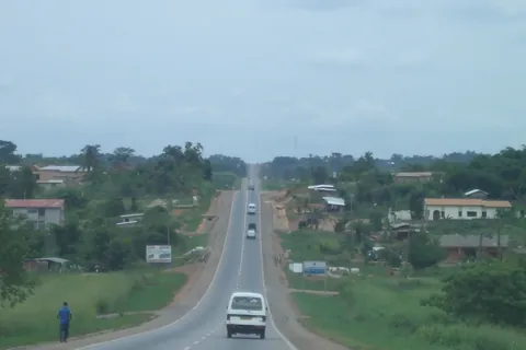
Quick answer: The road from Cape Coast to Takoradi is the coastal N1, west past the Elmina turn-off, through Kissi into the Western Region, then via Daboase Junction, Shama Junction and Inchaban into Sekondi-Takoradi. The section is 73.6 km according to Graphic Online and GNA, the length of the dualisation project. The Ghana Highway Authority publishes no Cape Coast–Takoradi figure, and there's no official journey time. Graphic Online said in January 2026 that the trip "is now two hours". The whole stretch is being dualised in 2026, so expect roadworks, and drive it in daylight.
This guide covers just the Cape Coast to Takoradi leg: the towns on the way, the 2026 roadworks, timings and car hire & rental between the two cities. If you're starting in Accra, our Accra to Cape Coast road trip guide covers the first leg and our Accra to Takoradi by road guide gives the whole-trip overview. We don't repeat them here.
Cape Coast to Takoradi at a glance
| Question | What we found (checked 30 October 2026) |
|---|---|
| Road | N1, single carriageway being dualised |
| Length | 73.6 km dualisation project (Graphic, GNA) |
| Official road distance | None published by the GHA |
| Drive time | No official figure; Graphic: "now two hours" (January 2026) |
| Regions | Central Region, then Western Region |
| Main junctions | Elmina turn-off, Kissi, Daboase Junction, Shama Junction |
| Roadworks | Whole section, three lots (see below) |
| Works due | 24 months from the October 2025 start (GNA) |
How far is Cape Coast from Takoradi?
There's no official road distance. The Ghana Highway Authority's road network table lists the whole N1 as 540 km from Elubo to Tema but gives no figure between Cape Coast and Takoradi.
The figure you'll see in the news is 73.6 km. That's the length of the N1 dualisation project, which Graphic Online reported when the President cut the sod in October 2025. GNA says the project runs from Cape Coast to the Takoradi Airport Roundabout, so your door-to-door distance depends on where you start and finish. A Graphic feature in January 2026 rounded it to 73 km.
How long does it take? We found no official journey time from the GHA or the Ministry of Roads and Highways. Graphic Online wrote in January 2026 that travel between Cape Coast and Takoradi "is now two hours", and said a broken-down truck on the narrow sections can cause hours of traffic. Treat two hours as a minimum, not a promise.
The route, town by town
The GHA's 2020 trunk road maps for the Central and Western regions (linked in the Sources list) show the N1 west of Cape Coast:
- Leave Cape Coast on the N1 west. The road north via Abura (towards Kakum) branches off near the city.
- Pass SSNIT Flat, where Elmina town lies just south of the N1.
- Continue through Atabadze, Bronyibima, Ayensudo, Nkwanta and Nyinaase to Kissi.
- Carry on through Aboransa, Dominase and Asemasa to the Western Region boundary.
- In the Western Region, pass Supon Dunkwa and Beposo to Daboase Junction, where a road heads north to Daboase.
- Continue through Annto to Shama Junction, then Inchaban, Mpentsem, Kojokrom and Fijai into Sekondi-Takoradi.
Place names are spelled as on the GHA maps; signs and news reports sometimes differ, for example Anto for Annto and Supomu Dunkwa for Supon Dunkwa.
Markets on the road
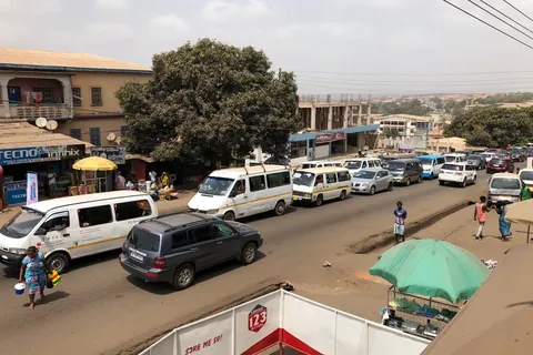
Expect slow traffic in the market towns. The Komenda-Edina-Eguafo-Abirem (KEEA) Municipal Assembly's 2026 budget lists markets at Kissi and Ayensudo, and says some communities along the Cape Coast–Takoradi highway have open-air markets for farm produce. The Shama District Assembly's 2026 budget calls Beposo market, held twice a week, its busiest. It also lists weekly markets at Shama, Shama Junction and Inchaban. Neither budget gives the market days.
Roadworks on the Cape Coast–Takoradi N1 (checked 30 October 2026)
The single carriageway is being turned into a dual carriageway with interchanges, drainage and walkways under the government's Big Push programme. The President cut the sod at Assorku Essaman in the Shama District on 21 October 2025. Graphic reported him saying the old road had outlived its usefulness and caused a lot of accidents.
GNA reported in June 2026 that the work was split into three lots, to be finished within 24 months:
| Lot | Section | What we found |
|---|---|---|
| 1 | Cape Coast to Kissi | No progress report found |
| 2 | Kissi to Daboase Junction | No progress report found |
| 3 | Daboase Junction to Takoradi Airport Roundabout | S&L Construction and Engineering (GNA) |
When GNA toured the Takoradi–Shama Junction section in June 2026, it saw excavation and culvert works. Drivers told GNA the road had become "deplorable", with rain creating more potholes.
On 16 September 2026, 3News reported that the Roads Minister had ordered warning letters to S&L over slow progress on the 23.6 km section between kilometres 164 and 187.6. He gave the contractor three weeks to show more work. 3News described S&L as responsible for two lots, while GNA named it only for Lot 3.
We found no report after 16 September 2026 saying whether the three-week deadline was met, no progress percentages for any lot, and no official completion date beyond GNA's 24 months. Graphic also reported in January 2026 that shops and structures were being demolished along the route, from the PTC Interchange in Takoradi through Kojokrom, Inchaban and Shama to Daboase Junction, Beposo and Cape Coast. Expect diversions, dust in the dry season, mud and potholes in the rain, and stops for site traffic.
Safety on the drive
The UK FCDO says street lighting is poor or non-existent and advises avoiding road travel outside the main towns after dark. For longer trips outside major cities it advises daylight travel. The KEEA budget says about 70% of the municipality's about 150 street lights were not working.
For this leg, that means:
- Leave in the morning so you reach Takoradi well before dark, even if traffic is bad.
- Take extra care at junctions, market towns and roadworks diversions.
- Overtake only where you can see well ahead, especially around the roadworks.
- If a truck breaks down ahead, wait rather than squeezing past on a narrow section.
Stops on the way
- Elmina. The castle is just off the N1. Our Elmina day trip guide has the history and opening hours.
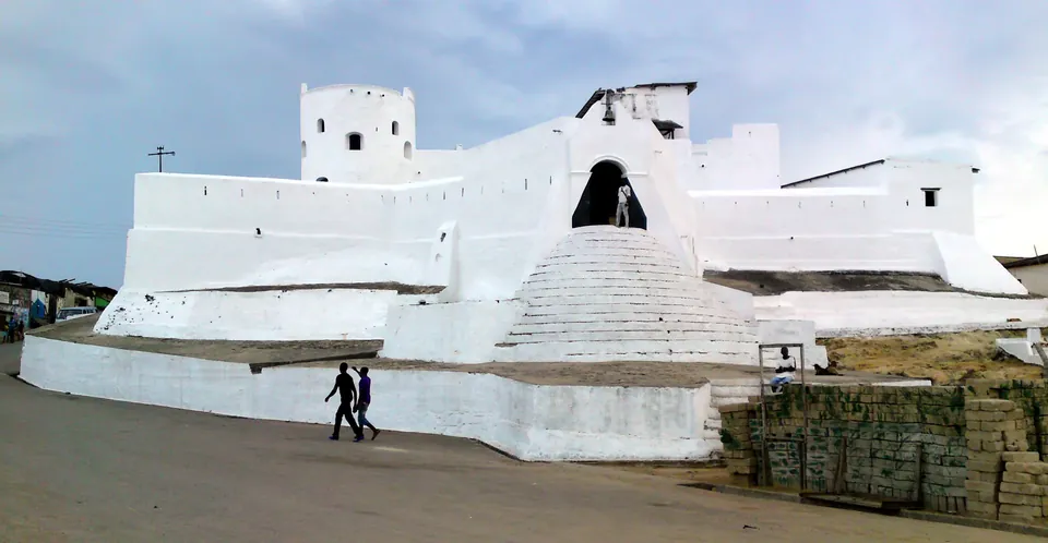
- Shama. The Shama District budget describes Fort Sebastian, the fort in our photo, as one of the oldest in the country and says it attracts few visitors. It stands on the coast at Shama, south of the N1; ask your driver for the turn-off. We found no official opening hours, so check locally.
Car rental & hire between Cape Coast and Takoradi
You have three main options:
- Hire in Cape Coast and drive west. Compare car hire & rental in Cape Coast.
- Hire in Takoradi and be collected in Cape Coast, or start a western coast trip from Takoradi. Compare car hire & rental in Takoradi.
- Keep the car and driver from Accra for the whole coast trip, if you already have one.
Business visitors who will need a car in Takoradi for several days should read our Takoradi business car hire & rental guide, which covers corporate drivers and Takoradi Airport.
Agree the terms in writing
| Agree in writing | Why it matters |
|---|---|
| One-way or return | The firm has to get the car back if you don't |
| Pickup time and address | So you arrive in daylight |
| Stops (Elmina, Shama) | So waiting time is in the plan |
| Driver's hours and overtime | Roadworks can make the trip much longer |
| Overnight terms | Driver's room and meals if you stay in Takoradi |
| Fuel, tolls and parking | So you know what's in the price |
| Vehicle type | Potholes, mud and diversions on the roadworks |
We don't publish prices, because they change often in Ghana. Ask each firm for a dated written quote, and never pay a deposit into a personal account that doesn't match the firm's name.
Frequently asked questions
How far is Cape Coast from Takoradi?
The Ghana Highway Authority publishes no Cape Coast–Takoradi road distance. The N1 dualisation project between the two cities is 73.6 km long, according to Graphic Online and GNA, running from Cape Coast to the Takoradi Airport Roundabout.
How long does it take to drive from Cape Coast to Takoradi?
There's no official journey time. Graphic Online wrote in January 2026 that the trip "is now two hours", and roadworks or a broken-down truck can add a lot more, so allow extra time and travel in daylight.
Which road goes from Cape Coast to Takoradi?
The N1. It runs west past the Elmina turn-off, through Kissi into the Western Region, then via Beposo, Daboase Junction, Shama Junction, Inchaban and Kojokrom into Sekondi-Takoradi.
Is the Cape Coast–Takoradi road being dualised?
Yes. The President cut the sod in October 2025 and GNA says the work, in three lots, is due within 24 months. In September 2026 the Roads Minister ordered warning letters to a contractor over slow progress. We found no later update or completion date as of 30 October 2026.
Is it safe to drive from Cape Coast to Takoradi at night?
The UK FCDO advises avoiding road travel outside the main towns after dark, and says street lighting is poor or non-existent. With roadworks along the whole section, plan to drive in daylight.
Can I hire a car one way from Cape Coast to Takoradi?
Some firms may allow it, but the firm has to get the car back. Ask about one-way terms in writing before you book, or hire a car with a driver who returns it.
Book your Cape Coast to Takoradi trip
Compare car hire & rental in Cape Coast and car hire & rental in Takoradi. Send each firm your date, pickup address, number of passengers and planned stops, and ask for the price, hours, one-way terms and overtime in writing.
Sources
- Takoradi-Cape Coast road dualisation starts: President cuts sod (73.6 km N1 section; single carriageway to dual carriageway with interchanges; sod cut at Assorku Essaman, Shama District; 22 October 2025) (Graphic Online)
- Big Push progresses steadily amidst heavy encroachment (Cape Coast–Takoradi travel time 'now two hours'; demolitions from the PTC Interchange through Kojokrom, Inchaban, Shama, Daboase Junction and Beposo to Cape Coast; 31 January 2026) (Graphic Online)
- "Speed up work," contractors on Takoradi-Cape Coast highway dualisation told (three lots, 24 months; excavation and culverts on Takoradi–Shama Junction; drivers report potholes; 22 June 2026) (Ghana News Agency)
- Agbodza issues warning letter to contractor over slow progress on Cape Coast-Takoradi dualisation (km 164–187.6, three weeks to improve; 16 September 2026) (3News)
- Road Network: N1 Elubo–Tema 540 km; no Cape Coast–Takoradi figure (checked 30 October 2026) (Ghana Highway Authority)
- Central Regional Trunk Road Map, 2020 (N1 west of Cape Coast via SSNIT Flat near Elmina, Atabadze, Ayensudo, Nyinaase, Kissi and Aboransa) (Ghana Highway Authority)
- Western Regional Trunk Road Map, 2020 (N1 via Supon Dunkwa, Beposo, Daboase Junction, Annto, Shama Junction, Inchaban, Kojokrom and Fijai to Sekondi-Takoradi) (Ghana Highway Authority)
- Shama District Assembly composite budget 2026: Accra–Takoradi highway through the district; Beposo market twice a week; Shama, Shama Junction and Inchaban markets; Fort Sebastian (PDF; checked 30 October 2026) (Ministry of Finance, Ghana)
- Komenda-Edina-Eguafo-Abirem Municipal composite budget 2026: markets at Kissi, Ayensudo and Komenda; open-space markets along the Cape Coast–Takoradi highway; street lighting (PDF; checked 30 October 2026) (Ministry of Finance, Ghana)
- Ghana travel advice: safety and security (daylight on longer trips, roads outside main towns after dark, poor street lighting; checked 30 October 2026) (UK FCDO)
Last checked: 30 October 2026. Rules, prices and advice change, so recheck official sources before you travel.
Related guides
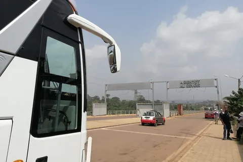
Takoradi to Elubo (Côte d'Ivoire Border) by Road: Route and Car Rental & Hire
Takoradi to Elubo by road: the N1 west to the Côte d'Ivoire border, roadworks, the GIS border post, entry rules and cross-border car hire & rental.
Photo: Enock4seth, CC BY-SA 4.0