Road trips
Accra to Hohoe and Wli Waterfalls by Car: Route via Asikuma, Have and Car Rental & Hire
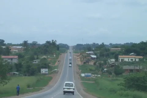
Quick answer: To drive from Accra to Hohoe and Wli Waterfalls, take the N2 from Tema over the Adomi Bridge to Asikuma Junction, then stay on the N2 north through Kpeve, Have and Ve Golokwati to Hohoe. Wli is east of Hohoe, near the Togo border. The Hohoe Municipal Assembly puts Hohoe about 220 km from Accra, and the Ghana Tourism Authority puts Wli about 280 km from Accra. No official journey time is published. Expect roadworks and dust on the Asikuma–Have and Have–Hohoe sections in 2026. The falls are open 8 am to 5 pm daily, so most people stay at least one night.
This guide covers the road beyond Asikuma Junction to Hohoe and Wli, the 2026 roadworks, visiting the falls and booking car hire & rental with a driver. Our Accra to the Volta Region guide gives the regional overview, and our Accra to Ho by car guide covers the shared road from Tema to Asikuma. We don't repeat them here.
Hohoe and Wli at a glance
| Question | What we found (checked 30 October 2026) |
|---|---|
| Region and district | Volta Region, Hohoe Municipality |
| Accra to Hohoe | About 220 km (Hohoe Municipal Assembly) |
| Ho to Hohoe | About 78 km (Hohoe Municipal Assembly) |
| Accra to Wli Waterfalls | About 280 km (Ghana Tourism Authority) |
| Drive time | No official figure published |
| Main road | N2 via Asikuma Junction, Kpeve, Have and Ve Golokwati |
| Roadworks | Asikuma–Have and Have–Hohoe (see below) |
| Wli opening hours | 8 am to 5 pm daily (GTA) |
| Best water flow | April to October (GTA) |
How far is Hohoe and Wli from Accra?
The Hohoe Municipal Assembly's 2026 budget, published by the Ministry of Finance, says Hohoe is about 220 km from Accra and about 78 km from Ho, the Volta regional capital. The Ghana Tourism Authority's Wli page puts Wli Waterfalls about 280 km from Accra.
Neither source says how these figures were measured. The Ghana Highway Authority's road network table lists the N2 as 640 km from Tema to Bakwu but gives no Accra–Hohoe or Accra–Wli figure.
How long is the drive? We found no official journey time from the GHA, the Ministry of Roads and Highways or the GTA. It's a long day: traffic leaving Accra and Tema, the roadworks below and stops all add time. Plan to leave early and arrive before dark.
The route: Accra to Asikuma Junction, then north to Hohoe
The GHA's 2020 trunk road maps for the Eastern and Volta regions (linked in the Sources list) show the main route:
- Leave Accra for Tema and take the N2 north through Kpong, Senchi and Atimpoku.
- Cross the Volta River on the Adomi Bridge and carry on to Asikuma Junction.
- At Asikuma, the N5 branches east to Ho. Stay on the N2 north through Adzokoe Peki and Kpeve.
- Continue on the N2 to Have, then through Nyangbo, Tafi, Logba and Ve Golokwati.
- Carry on north on the N2 to Hohoe.
The road from Tema to Asikuma is the same as for Ho. Our Ho guide and Akosombo guide cover that stretch, including the Atimpoku–Asikuma works. GBC reported in July 2026 that the 17.5 km Atimpoku–Asikuma Junction section was 32.3% complete and due in December 2027.
From Hohoe to Wli Waterfalls
The GTA's directions are: from Hohoe, drive east and turn right at Likpe Bakwa, and Wli is 3 km further on. The visitor centre is on the edge of the village. We found no official Hohoe–Wli road distance.
The GHA Volta map shows this as a regional road, the R070, from Hohoe through Fodome Dzogbega to Likpe Bakwa and Wli Avegame. The same road carries on south through the Fodome villages and rejoins the N2 at Ve Golokwati. The Hohoe budget lists both the Hohoe–Likpe road and the Wli–Golokwati road among the municipality's highways. So there are two ways to Wli:
- Via Hohoe, following the GTA directions.
- From Ve Golokwati, on the R070 through Fodome, without going into Hohoe.
We found no official figure for which is shorter or in better condition. The GHA's list of ongoing rehabilitation projects includes pipe culverts at Likpe on the Golokwati–Wli–Hohoe Road. Ask your driver which way is better on the day, especially after heavy rain.
Roadworks on the way to Hohoe (checked 30 October 2026)
The N2 north of Asikuma is part of the Eastern Corridor Road. Two sections were under construction in 2026:
- Asikuma–Have. GNA reported in November 2025 that the 45 km contract had been rescoped. The contractor said it was about 70% complete, with about 6 km of the final surface laid. MyJoyOnline reported that the Roads Minister inspected the Asikuma Junction–Have works in July 2026.
- Have–Hohoe. Citi Newsroom reported on 8 July 2026 that the contractor on the 53.35 km Have–Hohoe reconstruction had completed only 13% of its revised work programme. The Roads Minister gave it two months to reach 20% or face termination. The Ministry of Roads and Highways' Big Push page showed the project at 4.71% in April 2026.
Graphic Online reported in July 2026 that the minister found the communities along Have–Hohoe very dusty, with little watering of the road. Graphic gave the length as 56 km, while Citi, GNA and the ministry give about 53 km.
We found no report after July 2026 saying whether the 20% target was met or the contract was terminated, and no completion date for either section. Expect diversions, dust in the dry season and mud in the rain. Our rainy season driving guide has more on wet roads.
Road safety. GNA reported in June 2026 that the Volta Regional Minister was worried about the rising number of deaths on the Eastern Corridor Road. The UK FCDO advises travelling in daylight on longer trips outside major cities and avoiding road travel outside the main towns after dark.
Visiting Wli Waterfalls
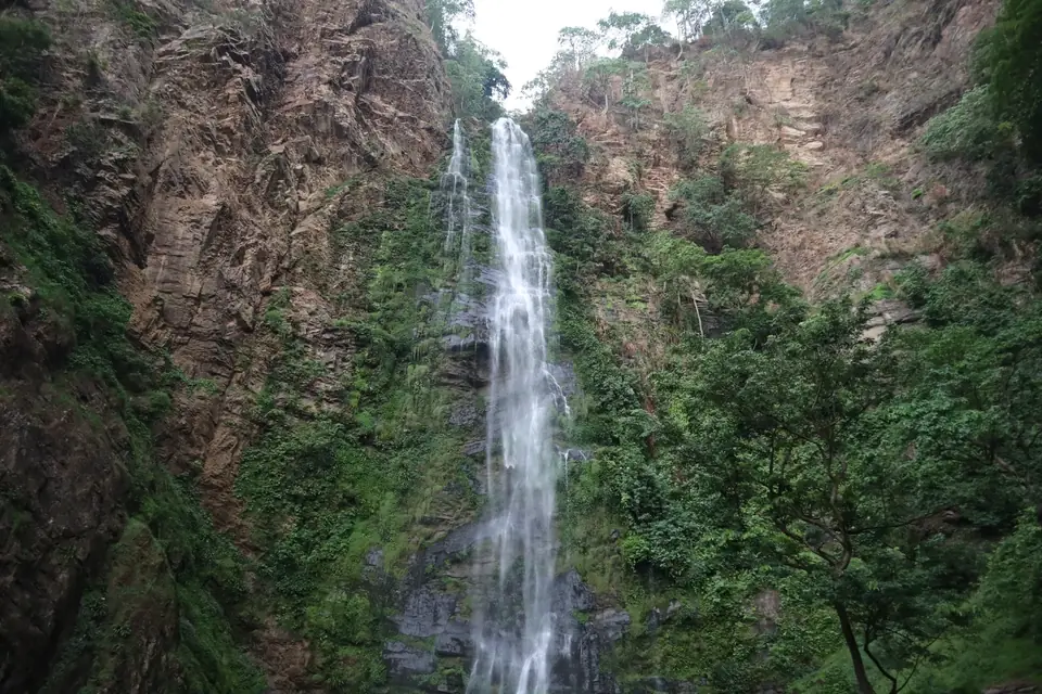
The GTA describes Wli, also called Agumatsa Falls, as the highest waterfall in West Africa. The Hohoe budget calls it the tallest. The walk goes through the Agumatsa Wildlife Sanctuary.
| What | What the GTA says |
|---|---|
| Opening hours | 8 am to 5 pm daily |
| Lower falls | Mostly flat trail with a guide, about 1.5 hours; crosses two rivers 8 times on bridges |
| Upper falls | Steep, challenging hike, about 4 hours; sturdy footwear |
| Best time | April to October, when the falls flow strongest |
| Rainy months | Upper falls hike is usually too slippery |
| Late afternoon | Fruit bats leave their roost near the lower falls |
| Facilities | Visitor centre with seating, drinks, gift shop and flush toilets |
| Staying over | Homestays and camping via the visitor centre; two hotels in Wli |
We don't quote entry or guide fees. Pay them at the visitor centre and ask for a receipt. The FCDO warns about self-appointed officials who try to charge fees to photograph well-known sites.
First aid. A reader's letter published by Graphic Online in June 2026 complained that no first aid or emergency vehicle was available when a visitor collapsed at the falls on 16 May 2026. We found no response from the GTA. Carry water, don't hike alone and tell your driver when you expect to be back.
GNA reported in June 2026 that the Volta Regional Minister cited efforts to improve access roads to Wli Waterfalls, but we found no details or dates.
Market days. The Hohoe budget lists Hohoe Central market on Mondays and Fridays and Wli Afegame on Wednesdays. Expect busier roads in town on those days.
Plan the trip
| Part of the trip | What to plan for |
|---|---|
| Leave Accra | Early, to get through Tema traffic and the roadworks |
| Asikuma Junction | Stay on the N2 north; the N5 goes to Ho |
| Kpeve to Hohoe | Roadworks and dust; allow extra time |
| Wli | Arrive with time to walk before the 5 pm close |
| Overnight | Stay in Hohoe or Wli rather than drive back after dark |
| Return | Leave in the morning to reach Accra in daylight |
Car rental & hire for Hohoe and Wli
Most visitors book in Accra. Compare car hire & rental with a driver in Accra. A driver who knows the Eastern Corridor can handle the roadworks and wait while you hike. If you're unsure whether to drive yourself, read our self-drive or chauffeur guide.
Agree the terms in writing
| Agree in writing | Why it matters |
|---|---|
| Pickup time and address | So you leave Accra early |
| Route (via Hohoe or Ve Golokwati) | So you both expect the same roads |
| Number of days and nights | A Wli trip usually needs an overnight stay |
| Driver's room and meals | Who pays on overnight stays |
| Waiting time at the falls | Upper falls hikes take about 4 hours |
| Fuel, tolls and parking | So you know what's in the price |
| Vehicle type | Dusty and muddy sections on the roadworks |
We don't publish prices, because they change often in Ghana. Ask each firm for a dated written quote, and never pay a deposit into a personal account that doesn't match the firm's name.
Frequently asked questions
How far is Hohoe from Accra?
About 220 km, according to the Hohoe Municipal Assembly's 2026 budget, which also puts Hohoe about 78 km from Ho. It doesn't say how the figure was measured, and the Ghana Highway Authority publishes no Accra–Hohoe road distance.
How far is Wli Waterfalls from Accra?
About 280 km, according to the Ghana Tourism Authority. From Hohoe, drive east and turn right at Likpe Bakwa; Wli is 3 km further on.
How long does it take to drive from Accra to Hohoe?
No official journey time is published. Traffic leaving Accra and Tema and the 2026 roadworks between Asikuma and Hohoe can add a lot of time, so leave early and plan to arrive before dark.
Which road goes from Accra to Hohoe?
The N2. Take it from Tema over the Adomi Bridge to Asikuma Junction, then stay on the N2 north through Kpeve, Have and Ve Golokwati to Hohoe. The N5 at Asikuma goes to Ho instead.
Is the Have–Hohoe road finished?
No. In July 2026 the Roads Minister said the contractor had completed only 13% of the revised programme and gave it two months to reach 20%. We found no later update or completion date as of 30 October 2026.
What time does Wli Waterfalls open?
The Ghana Tourism Authority lists 8 am to 5 pm daily. The lower falls walk takes about 1.5 hours and the upper falls hike about 4 hours.
Can I do Accra to Wli as a day trip?
It's possible but very long. Wli is about 280 km from Accra, there are roadworks on the way, and the FCDO advises against road travel outside main towns after dark. Most visitors stay at least one night in Hohoe or Wli.
Book your Hohoe and Wli trip
Compare car hire & rental with a driver in Accra. Send each firm your dates, pickup address, number of passengers and planned stops, and ask for the price, hours, overnight terms and overtime in writing.
Sources
- Hohoe Municipal Assembly composite budget 2026–2029: Hohoe about 78 km from Ho and 220 km from Accra; Eastern Corridor Road through the municipal capital; Hohoe–Likpe and Wli–Golokwati highways; market days; Wli Waterfalls and other attractions (PDF; checked 30 October 2026) (Ministry of Finance, Ghana)
- Wli Waterfalls: about 280 km from Accra in Hohoe Municipality; open 8 am to 5 pm daily; lower falls about 1.5 hours, upper falls about 4 hours; best flow April to October; from Hohoe turn right at Likpe Bakwa, Wli in 3 km (checked 30 October 2026) (Visit Ghana, Ghana Tourism Authority)
- Road Network: N2 Tema–Bakwu 640 km; no Accra–Hohoe or Accra–Wli figure (checked 30 October 2026) (Ghana Highway Authority)
- Eastern Regional Trunk Road Map, 2020 (N2 via Kpong, Senchi and Atimpoku to the Volta Region and Asikuma) (Ghana Highway Authority)
- Volta Regional Trunk Road Map, 2020 (N2 via Adzokoe Peki, Kpeve, Have, Logba and Ve Golokwati to Hohoe; regional road R070 Hohoe–Likpe Bakwa–Wli Avegame–Fodome–Ve Golokwati) (Ghana Highway Authority)
- Ongoing rehabilitation projects: Hohoe town roads and pipe culverts at Likpe on the Golokwati–Wli–Hohoe Road (checked 30 October 2026) (Ghana Highway Authority)
- Big Push Infrastructure Programme: Have–Hohoe Road (53 km) reconstruction 4.71% in April 2026; Hohoe–Jasikan 3% (checked 30 October 2026) (Ministry of Roads and Highways)
- Have–Hohoe road contractor given two months to achieve 20% progress or face termination (53.35 km, 13% of revised programme; 8 July 2026) (Citi Newsroom)
- Have-Hohoe road: Speed up work or have project terminated, Roads Minister warns contractor (dusty communities; 10 July 2026) (Graphic Online)
- Roads Minister begins fresh inspection of key projects in Eastern, Volta and Oti regions (Atimpoku–Asikuma Junction, Asikuma Junction–Have, Have–Hohoe; 8 July 2026) (MyJoyOnline)
- Minister calls for quality work, community engagement on major road projects (Asikuma–Have 45 km about 70%; Have–Hohoe 53.35 km; 18 November 2025) (Ghana News Agency)
- Roads Minister satisfied with progress on Atimpoku–Asikuma junction road project (17.5 km, 32.3% complete, due December 2027; 8 July 2026) (GBC Ghana Online)
- Volta region records major gains in education, health, infrastructure (access roads to Wli Waterfalls; Eastern Corridor Road fatalities; 19 June 2026) (Ghana News Agency)
- Gross negligence at Wli Waterfalls (reader's letter to the GTA about a medical emergency on 16 May 2026; 1 June 2026) (Graphic Online)
- Ghana travel advice: safety and security (daylight on longer trips, roads outside main towns after dark, self-appointed officials charging photo fees; checked 30 October 2026) (UK FCDO)
Last checked: 30 October 2026. Rules, prices and advice change, so recheck official sources before you travel.
Related guides
Takoradi to Elubo (Côte d'Ivoire Border) by Road: Route and Car Rental & Hire
Takoradi to Elubo by road: the N1 west to the Côte d'Ivoire border, roadworks, the GIS border post, entry rules and cross-border car hire & rental.
Photo: Enock4seth, CC BY-SA 4.0